Export your fiber route from your corporate mapping system and upload an OTDR .sor file. We calculate the exact GPS coordinates of the fiber break — with a street address — plotted on satellite imagery. Your field crew drives to the right span on the first roll.
OTDR hardware measures the fiber and stops — it has no idea where that number lands on a map. GIS and OSS platforms know where your plant is supposed to be, but none of them read a raw .sor file, and none of them take a field correction back from a tech standing at a splice case. Two essential, expensive categories of tooling — and nothing has ever connected them. Fiber Damage Locator reads the number your OTDR already gives you, resolves it against whatever plant data you have, and writes clean, GPS-precise as-built data back into your system of record. Not a cheaper alternative to either tool — the connection between them that was missing.
Three import modes. OTDR trace parsing. Satellite map. One red pin — at the break.
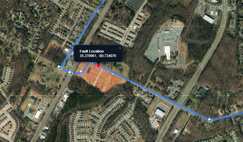
The fiber route is drawn on satellite imagery. Splice case markers show each documented node. Zoom in on the fault pin to see exactly which span and which building.
Works with exports from your internal GIS or network documentation platform — Esri ArcGIS, OSPInsight, Cityworks, QGIS, and others. If your team maps the fiber, this tool can locate faults on it.
Upload a .sor file. Fault distance is read automatically. Click Locate Fault — a red pin drops at the GPS coordinate with a reverse-geocoded street address.
Each span checks whether a road plausibly runs along the fiber's path — not just whether one's nearby — before snapping. Straight-line otherwise, so you get an honest guess instead of a misleadingly road-realistic wrong one.
Move the fiber route to match the actual cable run. The adjusted path improves fault accuracy by aligning cable-footage spans to their true geographic length.
Export any route as a .geojson file to your desktop. Load it back in later — build a growing library of cable paths without a central database requirement.
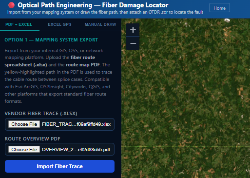
Export splice case GPS coordinates and measured cable footage from your internal GIS or network documentation platform — Excel or CSV, whichever your system produces. The route is built automatically and follows roads where a road plausibly runs along the fiber's path; drag waypoints on the map afterward to match the actual cable path exactly.
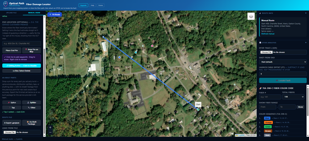
Drop a start pin and trace the fiber path point by point on the satellite map — drag to reshape, undo if you make a mistake. Place every splice enclosure, splitter, and tap you build at its real GPS coordinate, branch off a splitter for real FTTx tree topology, and attach the OTDR trace proving the loss at each splice. Export the route as GeoJSON for reuse, or export the whole as-built as one package.
Independent contractors carry OTDRs every day and generate .sor files at every job site. But without a GIS system or mapping platform, the fault distance is just a number. There has never been an affordable tool built specifically for the tech working alone in the field.
The Single User tier changes that. Draw your fiber route on the satellite map by clicking — no corporate system, no PDF, no spreadsheet required. Upload your .sor file. Get a GPS pin and street address at the fault. Export your route as a GeoJSON file and reload it next time you're on that same cable.
See Single User pricing →Contractors don't just find faults — they build splice cases, splitters, and taps every day, then have to hand the service provider clean as-built records for their GIS. That's usually a separate, manual chore: a hand sketch, a spreadsheet typed up after the fact, GPS coordinates estimated from memory.
Manual Draw now doubles as an as-built capture tool. Place every part at its real GPS coordinate, branch off a splitter for real FTTx tree topology, attach the OTDR trace proving the loss at each splice — then export one package: CSV, Excel, GeoJSON, and a labeled PDF map, ready to hand over.
For BEAD-funded builds, that package doubles as the physical as-built record most state compliance plans require you to keep on file for five years — captured as a byproduct of the work, not a separate paperwork chore afterward.
See how it works →Ticket comes in. Pull the fiber route from your internal mapping system, attach the OTDR trace, hit Locate Fault, and dispatch the field crew to the right span before anyone drives anywhere wrong.
Before breaking ground to repair, confirm which span the break is in and which splice case enclosure is closest. Reduces unnecessary excavation.
Pull up the route on a tablet before heading out. See the exact location on satellite imagery and navigate to it directly from the fault result.
Draw and export every cable run you work on. Your GeoJSON route library lives on your machine — reload any route instantly the next time you're called back to that circuit.
No credit card. Full access. Import a route from your mapping system on your first login.
Start Free Trial